Skip to main content
Skip to "About this site"
Language selection
Français
Government of Canada /
Gouvernement du Canada
Search and menus
Search and menus
Search
Search website
Search
Topics menu
Jobs
Immigration
Travel
Business
Benefits
Health
Taxes
More services
You are here:
Home
CanSIS
Publications
Soil Surveys
British Columbia
Soils of the Taseko Lakes Area, British Columbia
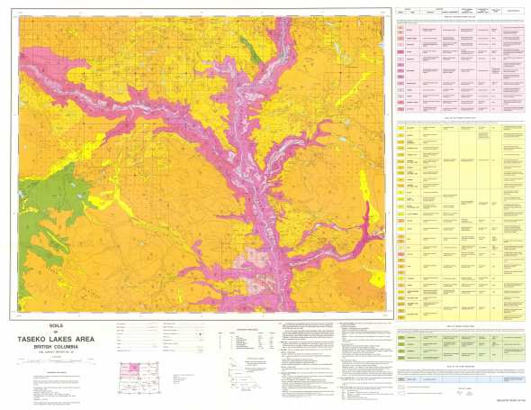
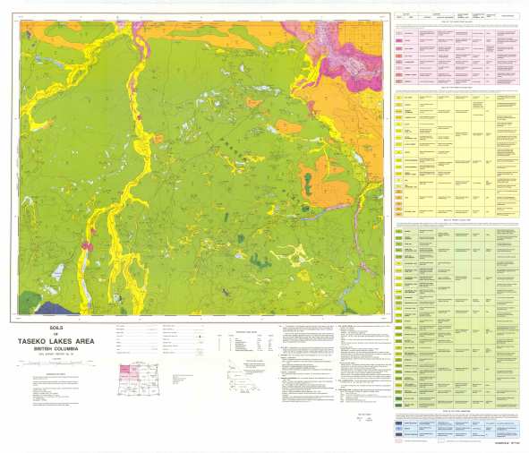
MAP NORTHEAST
MAP SOUTHEAST
MAP SOUTHWEST
MAP NORTHWEST
Report a problem or mistake on this page
Date modified:
2013-06-25