Agricultural Potential of Selected Areas in the Northwest Territories
Soil capability for agriculture map, Slave River

Soil capability for agriculture map, Slave River (JPG, 721 KB)
Potential for native hay and grazing map, Slave River

Potential for native hay and grazing map, Slave River (JPG, 702 KB)
Soil capability for agriculture map, Liard & Mackenzie River
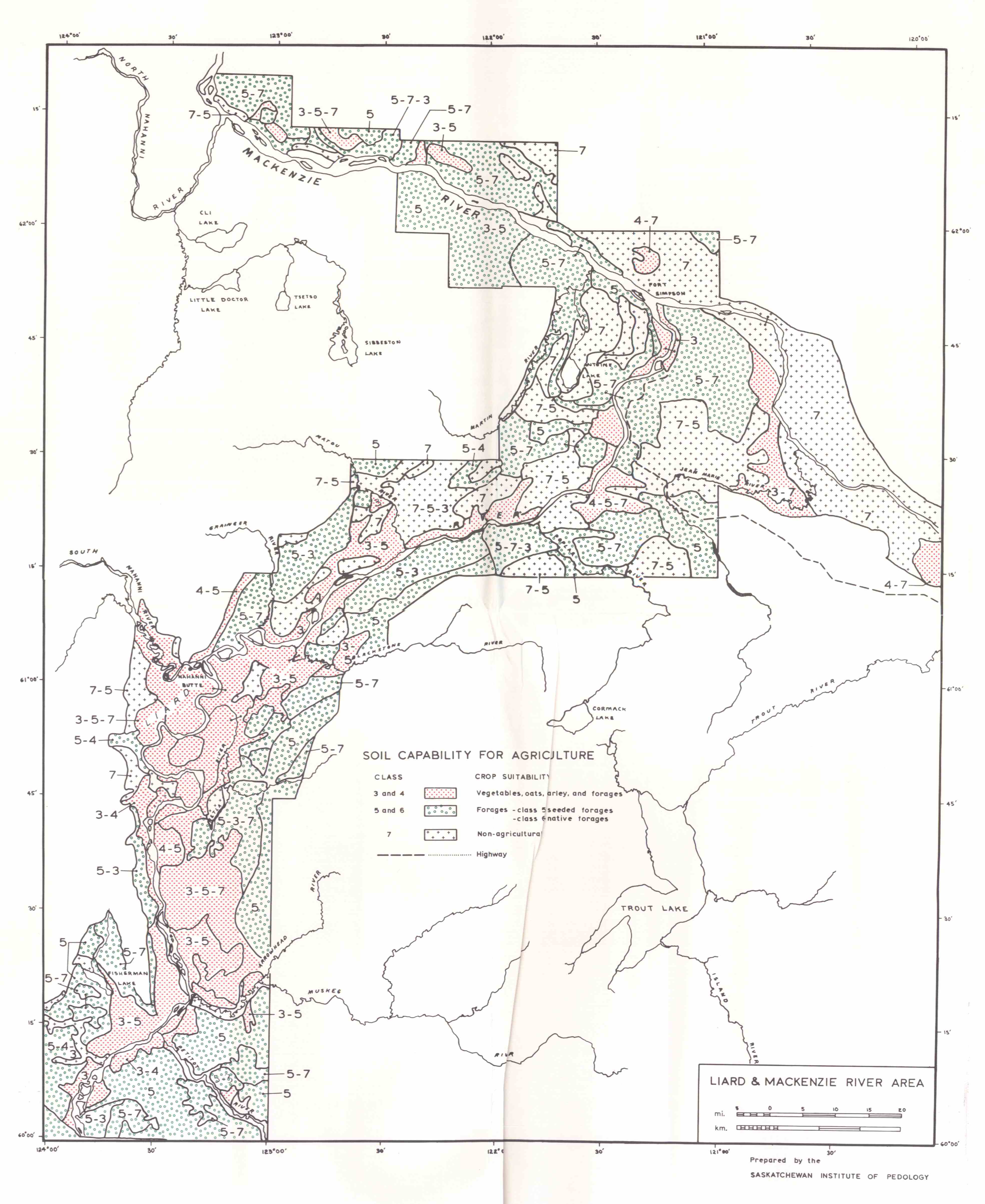
Soil capability for agriculture map, Liard & Mackenzie River (JPG, 789 KB)
Soil capability for agriculture map, Upper Mackenzie River
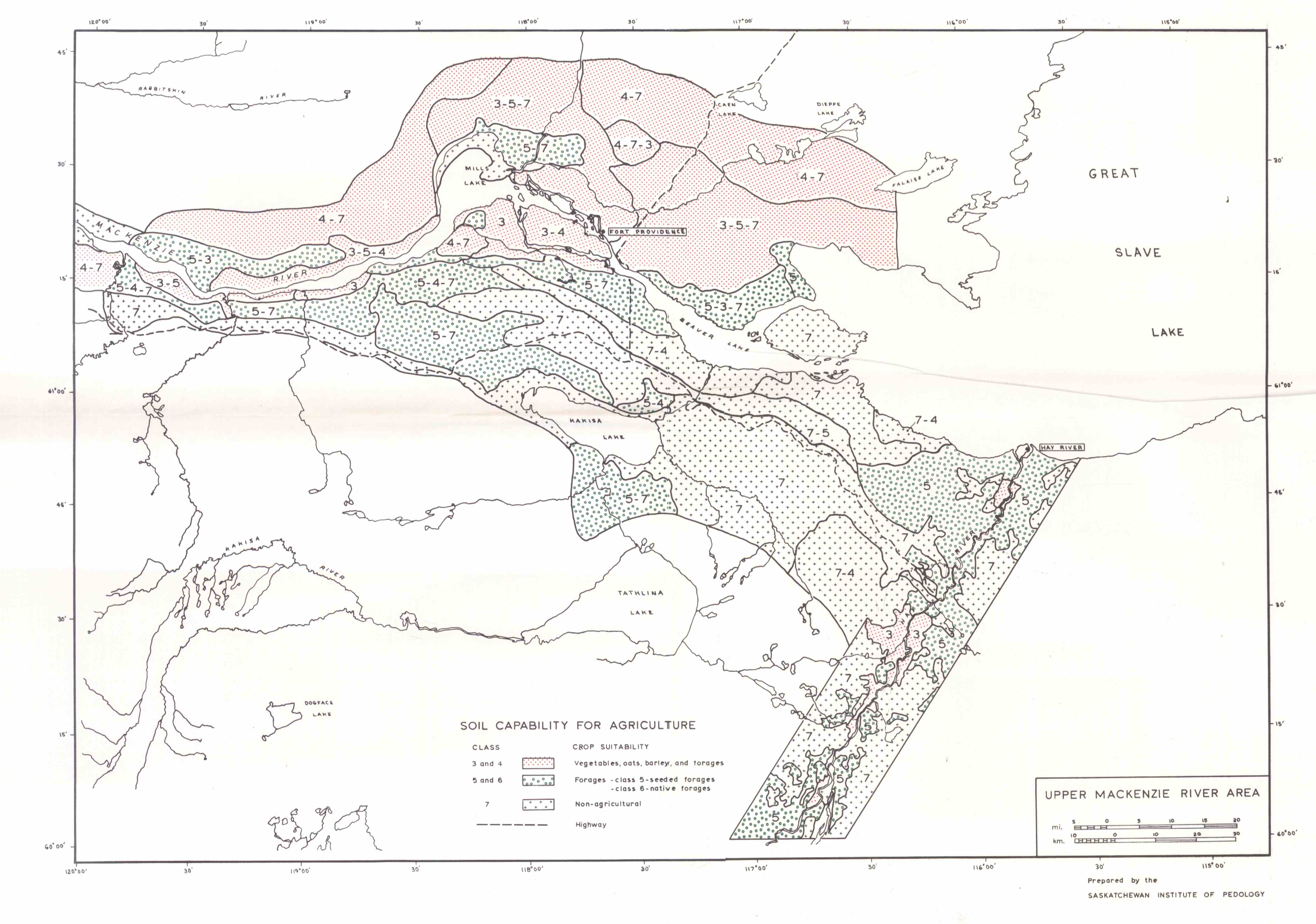
Soil capability for agriculture map, Upper Mackenzie River (JPG, 750 KB)