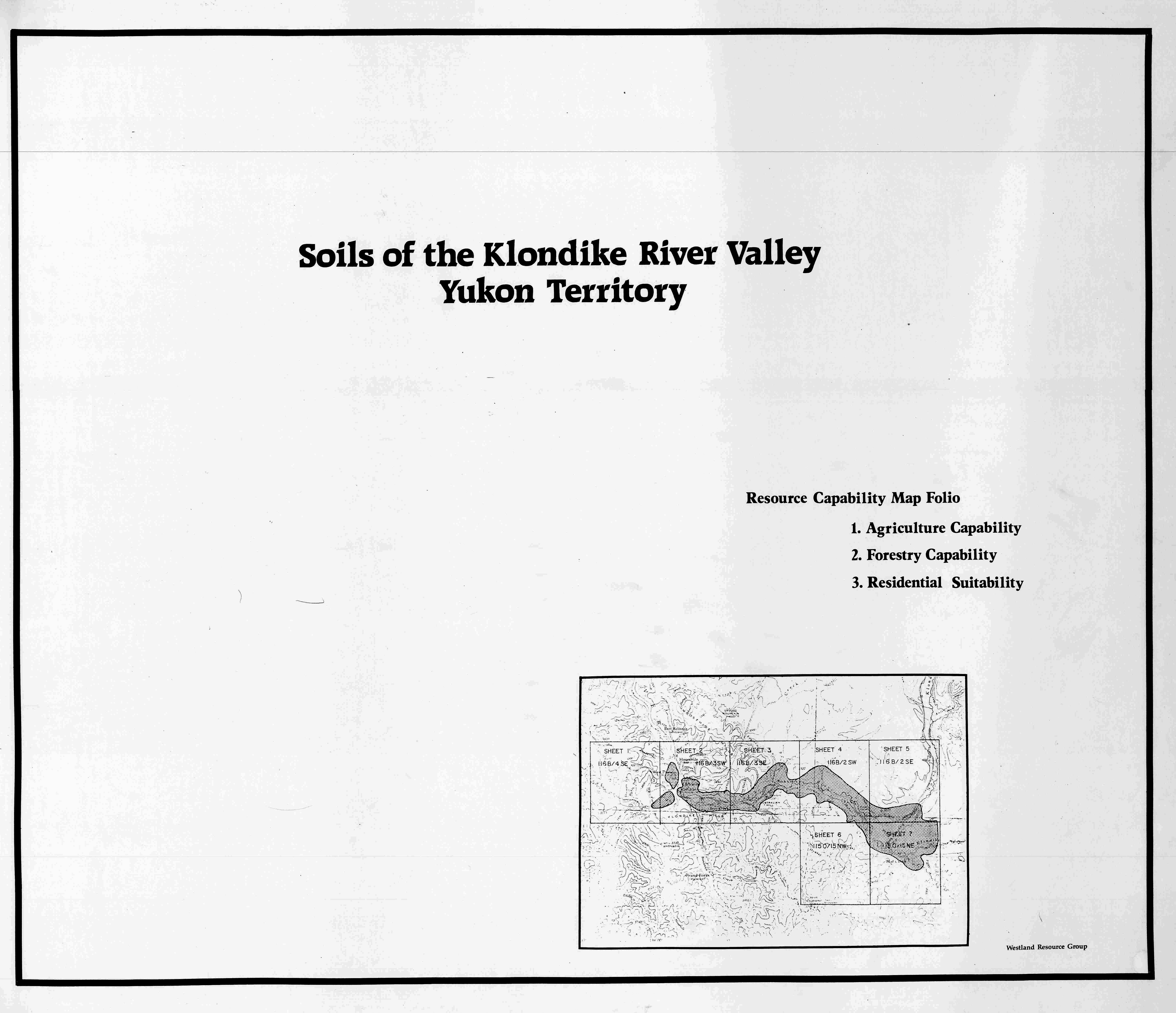
Soil Survey of the Klondike River Valley (PDF, 2.76 MB)
Index map (JPG, 1.84 MB)
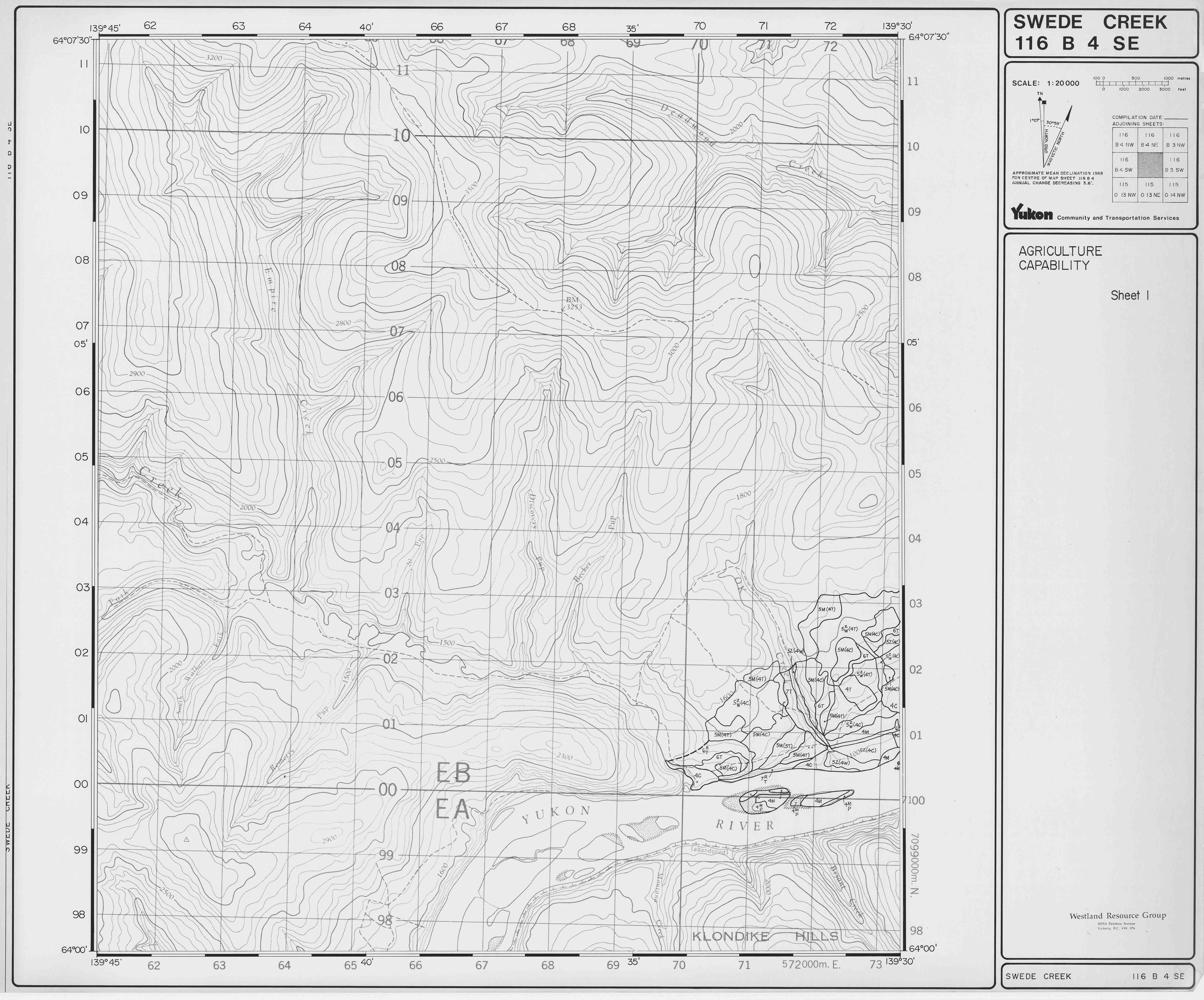
Agricultural capability map - sheet 1 (JPG, 5.48 MB)
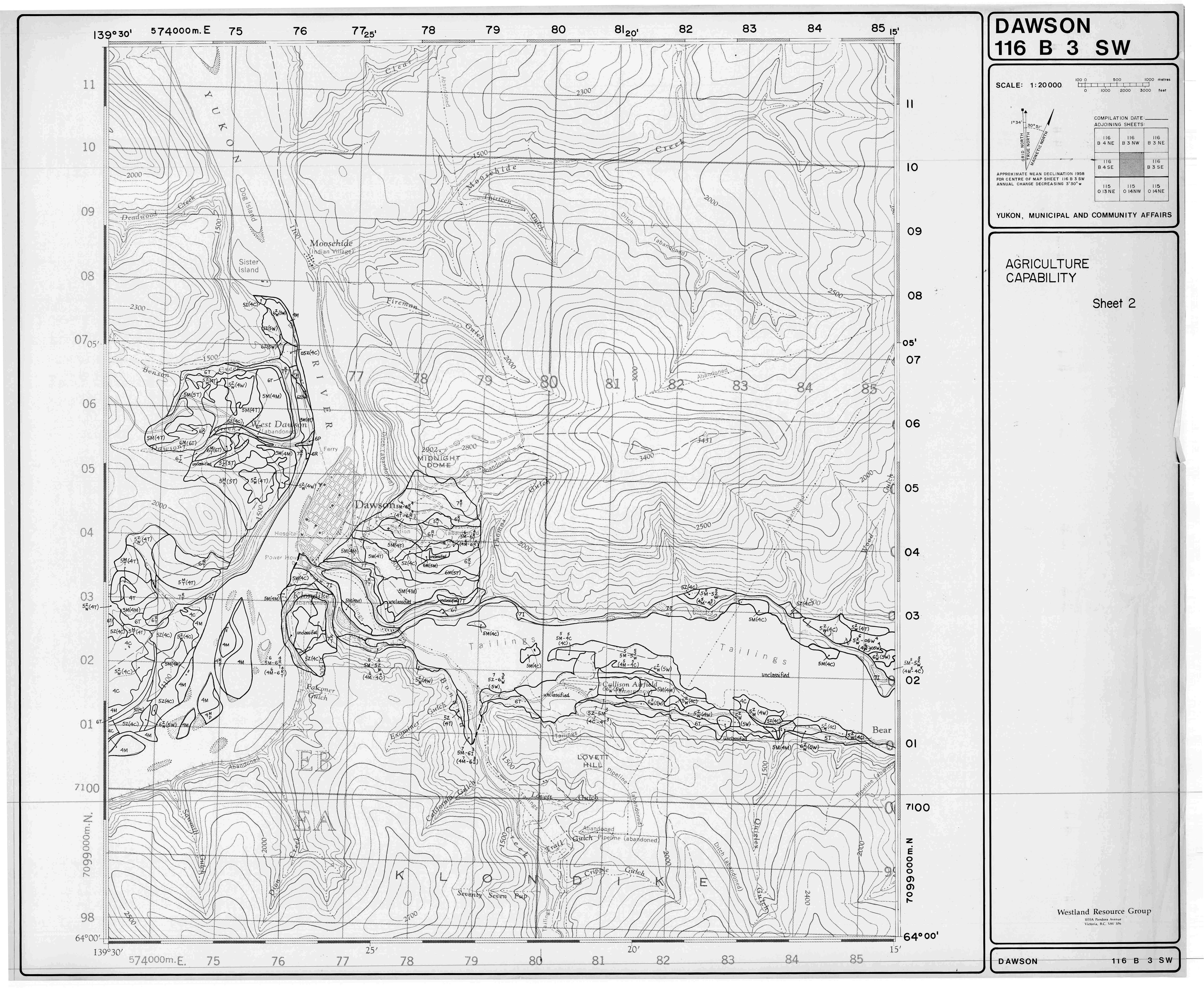
Agricultural capability map - sheet 2 (JPG, 7.69 MB)
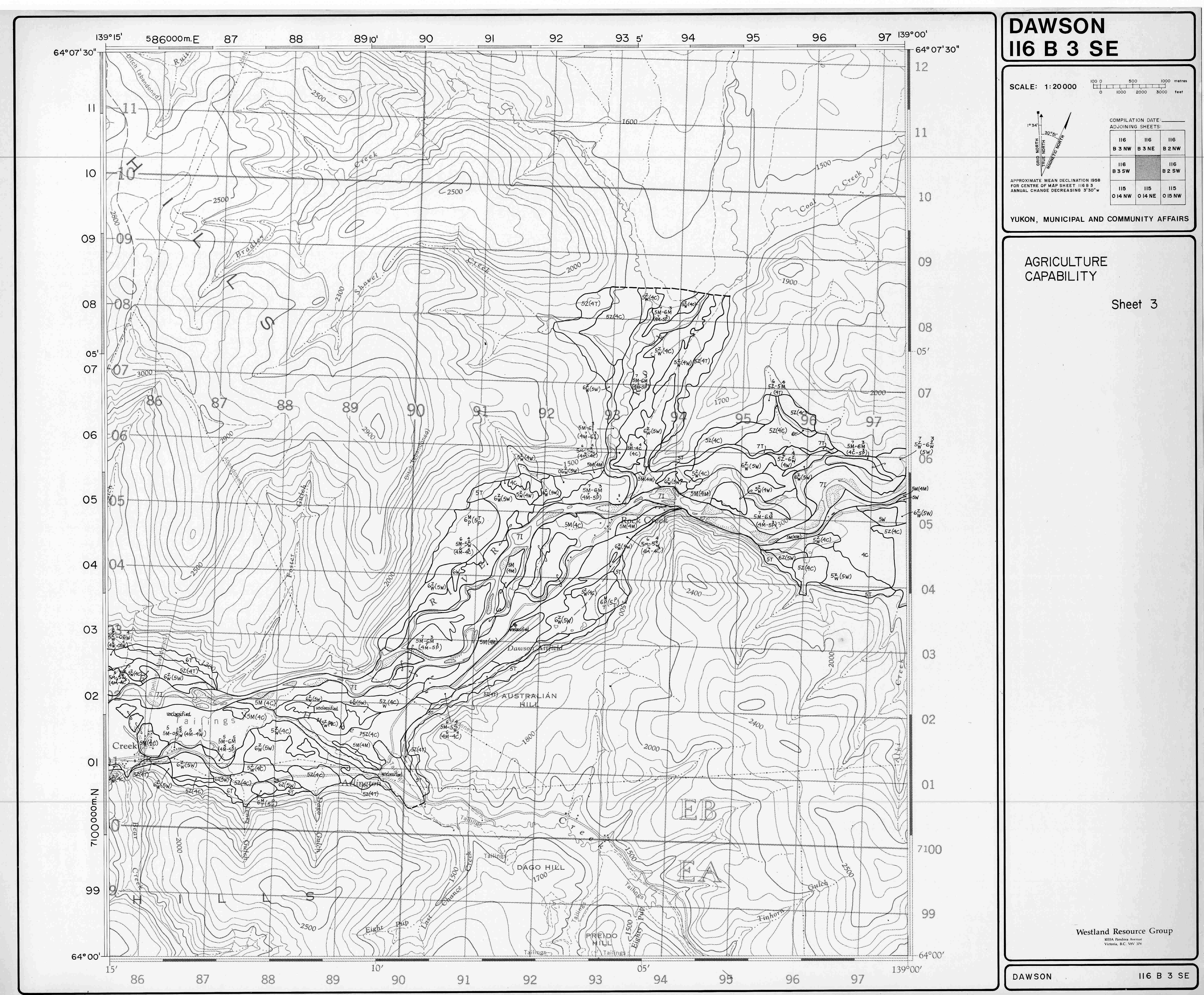
Agricultural capability map - sheet 3 (JPG, 5.41 MB)
Agricultural capability map - sheet 4 (JPG, 5.2 MB)
Agricultural capability map - sheet 5 (JPG, 5.13 MB)
Agricultural capability map - sheet 6 (JPG, 6 MB)
Agricultural capability map - sheet 7 (JPG, 5.92 MB)
Agriculture capability legend (JPG, 2.12 MB)
Forestry capability map - sheet 1 (JPG, 7.28 MB)
Forestry capability map - sheet 2 (JPG, 7.03 MB)
Forestry capability map - sheet 3 (JPG, 6.45 MB)
Forestry capability map - sheet 4 (JPG, 5.82 MB)
Forestry capability map - sheet 5 (JPG, 5.06 MB)
Forestry capability map - sheet 6 (JPG, 5.42 MB)
Forestry capability map - sheet 7 (JPG, 5.18 MB)
Forestry capability legend (JPG, 1.58 MB)
Residential suitability map - sheet 1 (JPG, 7.6 MB)
Residential suitability map - sheet 2 (JPG, 7.54 MB)
Residential suitability map - sheet 3 (JPG, 6.45 MB)
Residential suitability map - sheet 4 (JPG, 5.87 MB)
Residential suitability map - sheet 5 (JPG, 5.15 MB)
Residential suitability map - sheet 6 (JPG, 5.41 MB)
Residential suitability map - sheet 7 (JPG, 5.69 MB)
Residential suitability legend (JPG, 3.35 MB)
Soil survey map - sheet 1 (JPG, 6.27 MB)
Soil survey map - sheet 2 (JPG, 7.34 MB)
Soil survey map - sheet 3 (JPG, 6.71 MB)
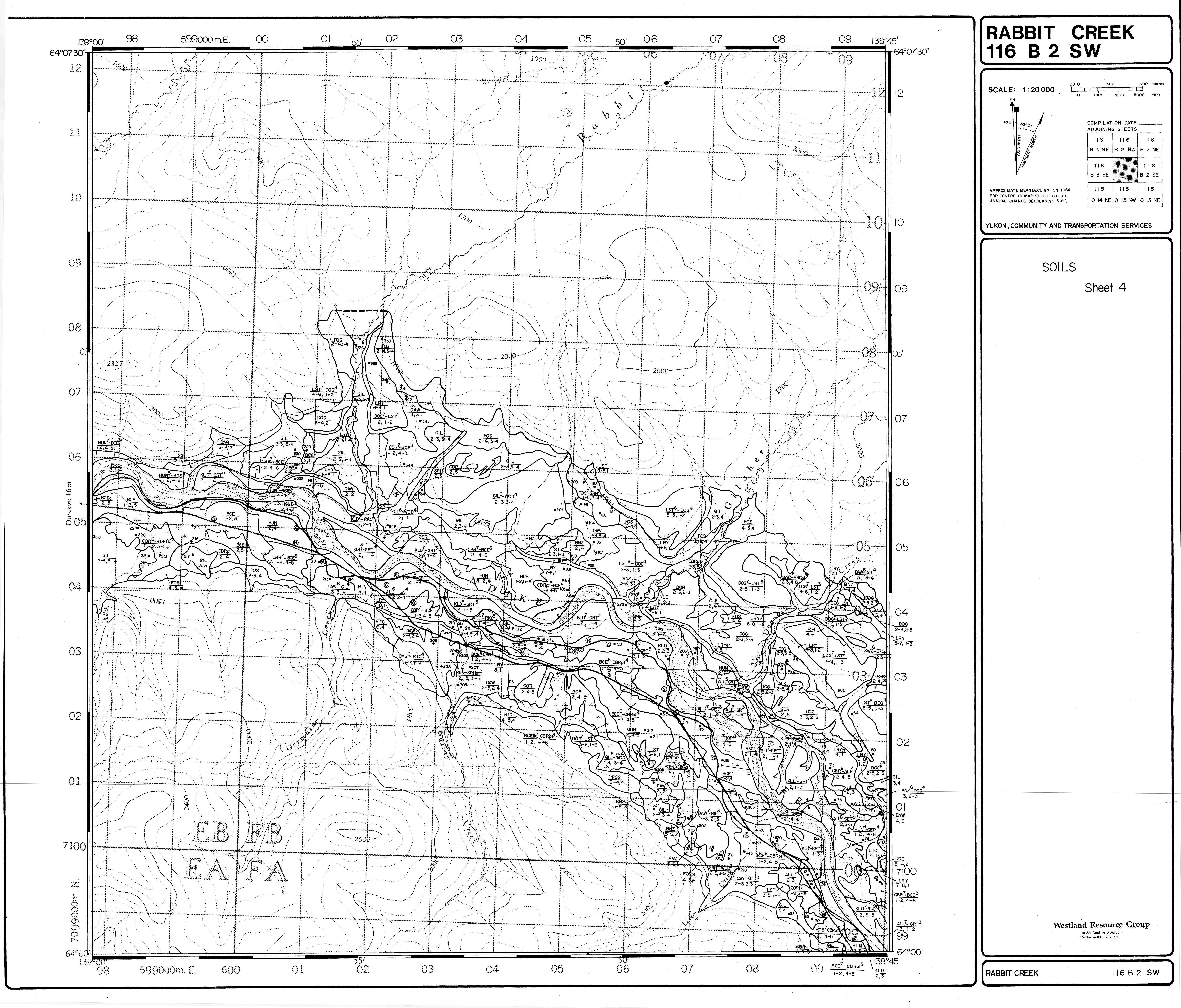
Soil survey map - sheet 4 (JPG, 5.59 MB)
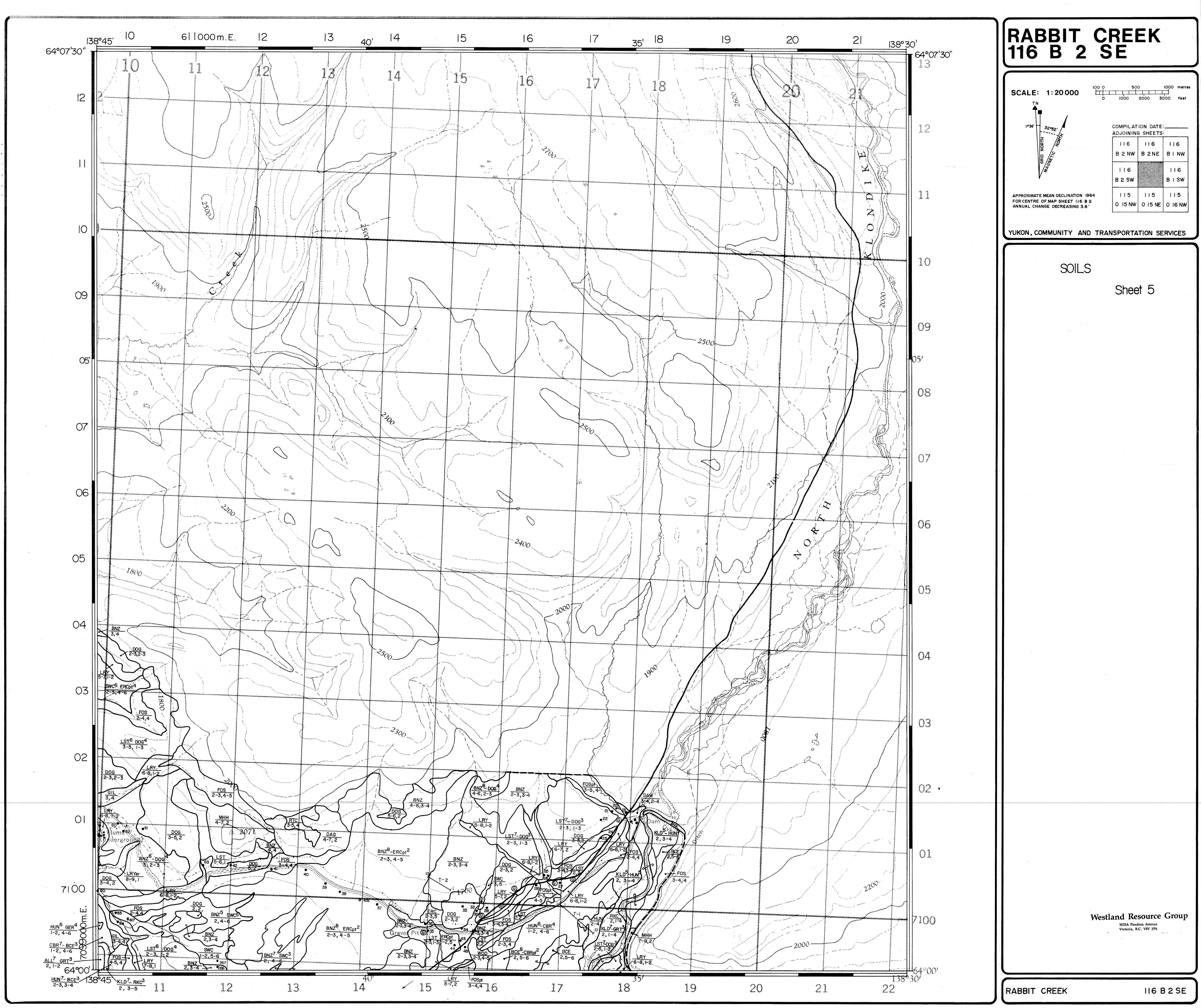
Soil survey map - sheet 5 (JPG, 4.85 MB)
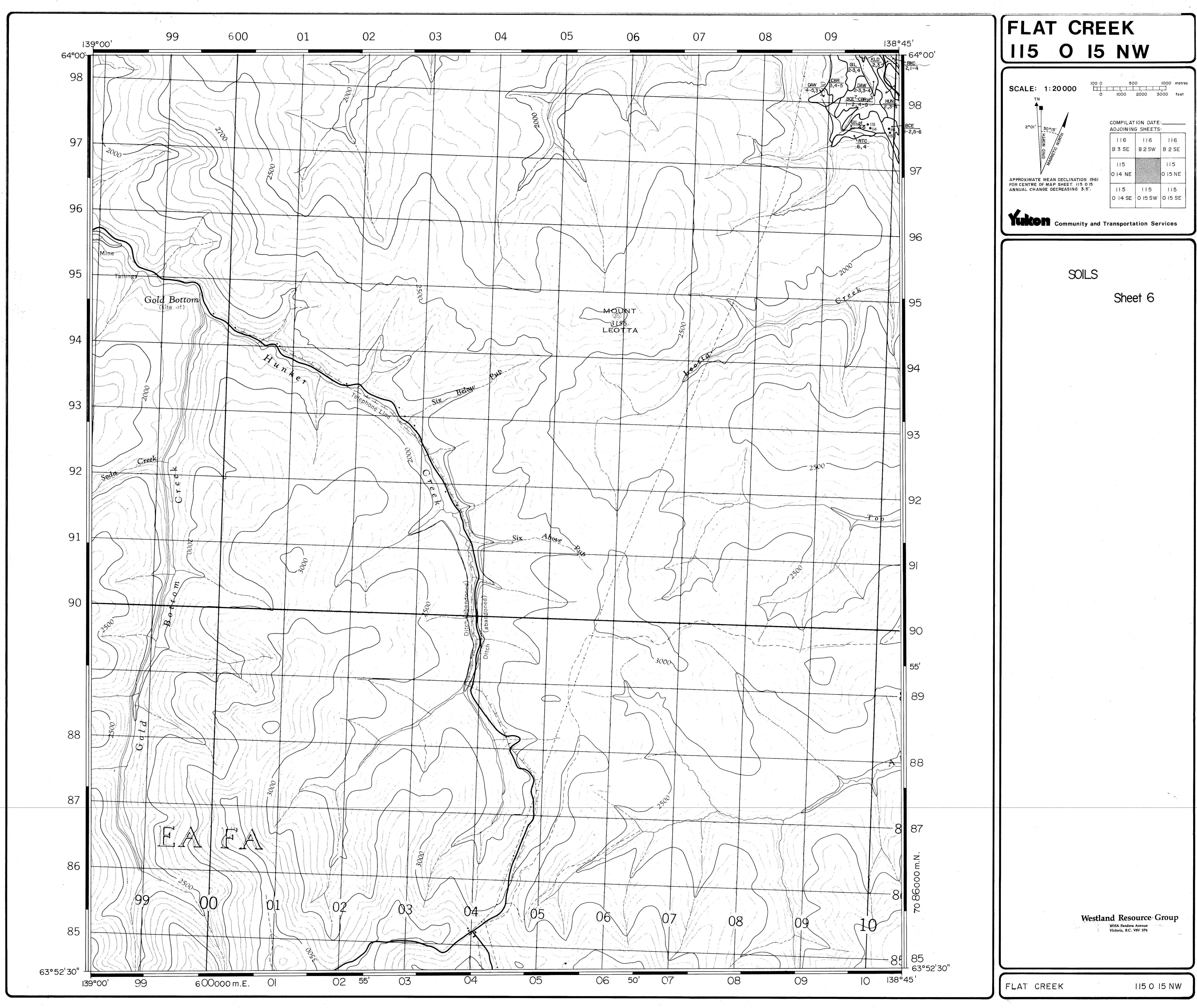
Soil survey map - sheet 6 (JPG, 4.66 MB)
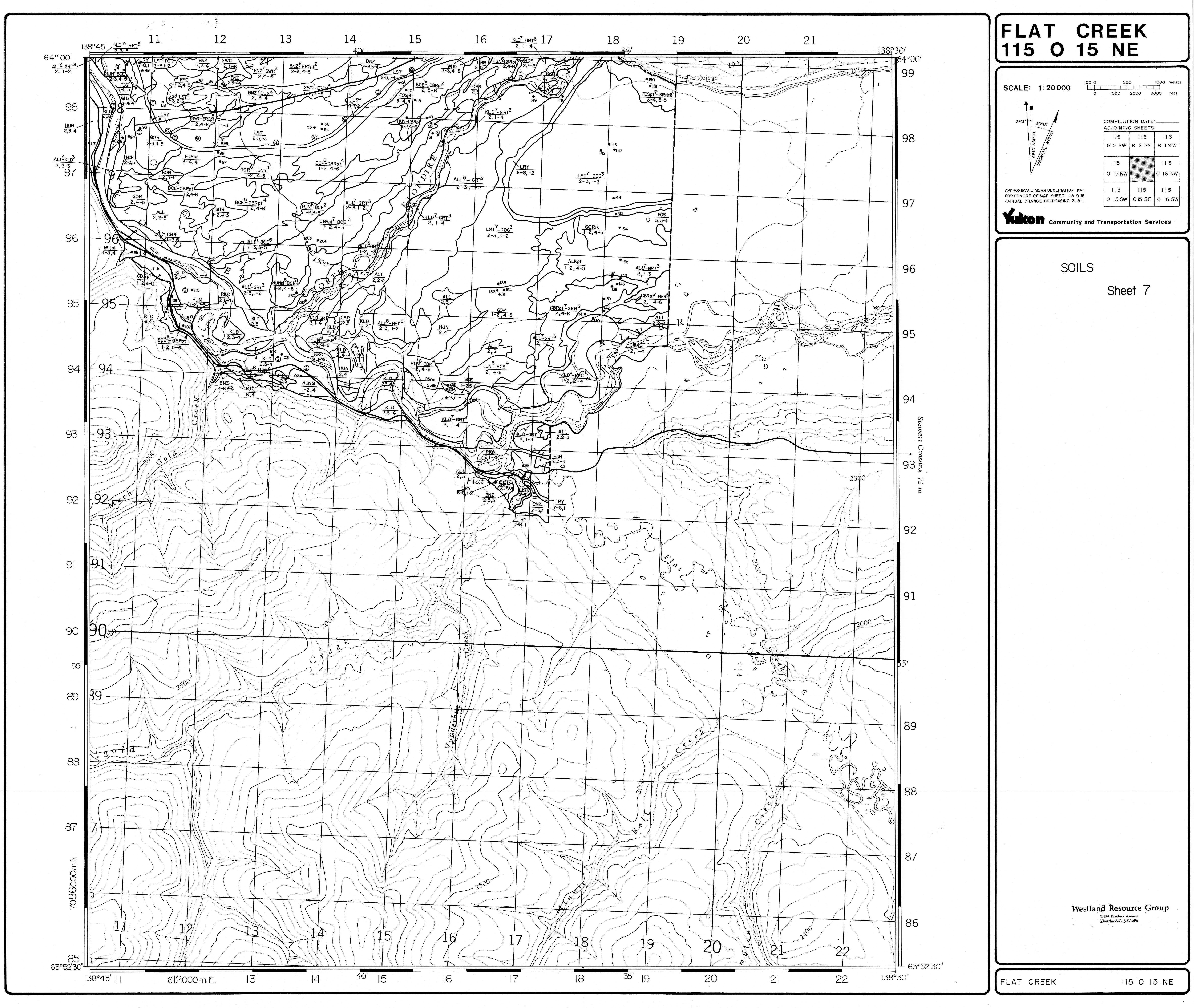
Soil survey map - sheet 7 (JPG, 4.85 MB)
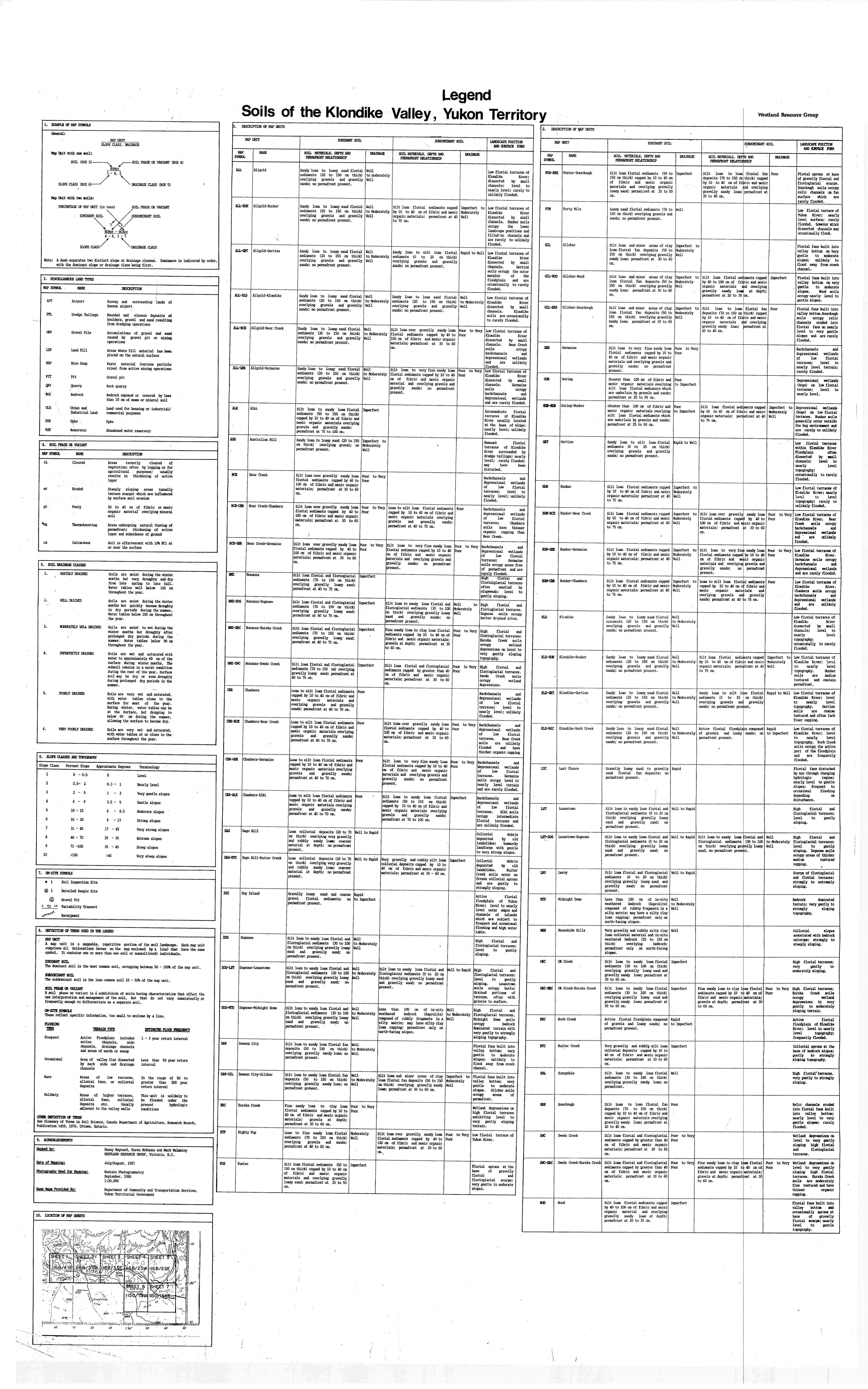
Soil survey legend (JPG, 5.09 MB)